Gwangmyeong City 관명시

Gwangmyeong means prosperous life. located southwest of Seoul, it’s known for several large discount shopping centers like IKEA, Costco, Lotte Premium Outlet, etc.

Location in South Korea

I started the day off at IKEA. I have never had Swedish meatballs, so I was pretty excited to check out the IKEA food court.

DSC01724

DSC01592

DSC01597

DSC01599

DSC01605

The shopping experience at IKEA was pretty similar to the ones I had in the US. There was a large selection and the prices were similar to that in the US.

DSC01617

DSC01622

DSC01625

DSC01626

IKEA, Lotte Outlet, and Costco and all located on the same intersection, but since they open late, I decided to check out the nearby Gwangmeyong Cave before it closed.


Gwangmyeong Cave is an artificial cave built in 1912 and used until 1931 to dig gold, silver, copper, and zinc to make weapons for the Japanese army. After liberation from Japan, the mine was reopened and used by a Korean company until it went bankrupt largely due to a major flood in 1972. It’s been open to tourists for only a few years now (since 2011.)


DSC01644

DSC01658

DSC01677

DSC01681

DSC01711

Operating Hours: 9am – 6pm (Closed Mondays)

Admission Fees: Adults 4,000 won

Average Viewing Time: 1-2 hours

Contact Info 02-2680-6550

Click to access 2015_GuideMap_English.pdf


After the cave, I went back to the Lotte Outlet for shopping and dinner.

DSC01607

DSC01736


DSC01737

SOURCES:

http://english.visitkorea.or.kr/enu/ATR/SI_EN_3_6.jsp?cid=2011088

http://minienmonde.blogspot.kr/2015/07/gwangmyeong-escape-summer-heat-daytrip.html

Inje County 인제군

Inje County is a county in Gangwon Province, and it has the lowest population density of any South Korean county, so it’s definitely not a tourism hot spot, but I wanted to go somewhere I hadn’t been to before, so the past weekend I went camping in Inje. Inje’s call to fame is probably its mountains. Although most people think of Seokcho City 석초시 when they think of the famous Seorak Mountains 설악산, the Inner Seorak Mountain Range 내설악 is located in Inje. That means there are lots of great hiking trails and deep creeks to swim in, making Inje a great summer or fall destination.

File:Gangwon-Inje.svg

TRAVEL COURSE: DAY ONE

1. Set up camp at 구만동 Camping Site

2. Swimming at Baekdam Creek 백담계곡

3. Baekdamsa Temple 백담사


TRAVEL COURSE: DAY TWO

1. Zip Track

2. More Swimming at Baekdam Creek 백담계곡


TRAVEL COURSE: DAY THREE

1. Birch Tree Forest 자작나무숲


I arrived in Inje on a Saturday morning.  The campsite I went to was pretty spectacular, but I forgot to take photos of my tent. The site was located right in front of a stream북천, and there were little streams going all throughout the camp site, so you could put your drinks or fruits in and use it as a cooler.

Once I set up my tent, I went swimming at Baekdam Valley 백담계곡. The water was so deep that there were multiple places where people could dive from. You can’t really tell from the photos just how deep the water is, but one of the locals told me that someone drowns year every year. 😦 If you go there, I highly recommend bringing a life vest or at least a tube.


Baekdam Creek Admission Fee: none

Parking Fee: 5,000 won per day

Operating Hours: –

Average Viewing Time: 2-3 hours

After swimming for a couple hours, I took a bus to the nearby Baekdamsa Temple 백담사. It’s possible to walk there, but the road is pretty narrow, and there isn’t a separate lane for pedestrians, so I don’t recommend it.

The temple itself wasn’t that special, but the view there of Seorak Mountain was pretty nice.

Baekdamsa Temple Admission Fee: none

Bus Ride Fee: 2,300 per adult, one-way ticket

Operating Hours: last bus 6 pm

Average Viewing Time: 20-40 minutes

There were some hiking trails that led deeper into the mountains here.

The next day, I headed off to try some ziplining. There is a large river called Naerin River 내린천 which is were many of the recreational activities in Inje are based around. Rafting and kayaking are pretty popular here. There is also bungee jumping and ziplining, which aren’t technically water related, but the ones here go across or above that river which makes it more interesting.

The place I went to let you do a few quick rides across land to get you adjusted, then you went on two long rides across Nerin River 내린천.

This was a bungee jumping site. There were several places along that river.

I went for a drive and saw the Maebawi Falls 매바위 폭포 which was an artificial waterfall.

After that, I went back to Baekdam Valley for another day of swimming.

My last day in Inje, I went to check out the Birch Forest 자작나무숲. The birch forest is on the top of a mountain that you have to hike up. The hike took an hour and a half each way, so we had to get here early. Most of the path looked like a typical Korean forest with lots of pine trees. There were a few birch trees a long the way though.

This was the entrance. It was still looked like a typical Korean forest.

Then suddenly, everything changed!

There were birch trees as far as I could see. I felt like I was on another planet. It’s hard to tell from the pictures, but the color contrast from the brown and dark green forest just a few feet below to the white and yellowish-green forest was just so unexpected. I thought there would be a bunch of birch trees, but I was not expecting the birch forest to be this large and vast. It was almost unbelievable how this sort of thing could exist on the top of an ordinary mountain.

And that was it for Inje this weekend. Time to head back to Seoul~

Jeju Island 제주도

FOUR DAY ITINERARY

DAY ONE

3:30 Leave Gimpo Airport

4:30 Arrive at Jeju Airport, Rent a car

5:30 Arrive at Hamdeok Beach 함덕 해수육장

Eat Black Pig 흑돼지

DAY TWO

10:00-2 Kim Young Beach

Phoenix Island

DAY THREE

Aquaplanet

쇠소까 water bike

돈내코계곡

seawalk

DAY FOUR

????

At the airport


Arrived at Hamdeok Beach 함덕 해수육장


Eating Jeju Black Pork 흑돼지 and some dessert

Kim Young Beach 김영 해수육장


Stopped by the Dongmun Market 동문시장 for some fresh seafood


Phoenix Island


Aquaplanet


쇠소깍 Estuary


My first time seawalking


Pocheon City 포천시

This post contains photos from several different days. Since Pocheon is one of my favorite weekend getaways, I often go there for camping, and have lots of great photos that I’ve been meaning to post, so I’ll just combine them into one.

Pocheon 포천 is just north of Seoul and takes about an hour and a half to get there by car. The area is made up mostly of forests, so it’s a great place to go when you want a break from the city.

File:Gyeonggi-Pocheon.svg

TRAVEL COURSE: DAY ONE

1. Pocheon Art Valley

2. Herb Island 허브 아일랜드

3. Camping by Sanjeongho Lake 산정호수


TRAVEL COURSE: DAY TWO

1. Sancheonho Lake

2. Myeongsungsan Mountain


Herb Island is a theme park made up of a complex of exhibition halls and gardens. It was much larger than I thought it would be. I highly recommend going there in the late afternoon so that you have a chance to check it out both during the daylight and at night, because there a lights set up all year round.


There were lots of unique plants and flowers. I actually liked Herb Island better than 아침교유숙목원 which is another popular garden/arboretum in Gyeonggi Province because Herb Island specialized in unique looking plants while the other garden focused on pretty flowers. I thought Herb Island was more educational. On one end of the park, there was an area called Venezia which basically mimicked that city in Italy. You could ride mini gondolas here for a small fee.


There was also a small zoo that included peacocks, goats, rabbits, and donkeys. Cups of carrots were sold for 1,000 won each to feed the donkeys.

There were several restaurants here and even a bakery, but the best one by far was a Korean BBQ restaurant called 허브갈비. Both the meat and the cold buckwheat noodles 냉면 that I had was flavored with herbs and flowers grown at this theme park.

The night time displays were pretty nice too. The park closed at 11 pm so there was plenty of time to look around.


Herb Island Operating Hours: 9am-10pm Sun-Fri / 9am–11 pm Sat Open all year round.

Admission Fee: 6,000 won / adult

Average Viewing Time: 3+ hours

Contact Information: 031) 535-6494   herbisland.co.kr

Sanjeongho Lake was originally made in 1925 as a reservoir for agricultural purposes. It is now a tourist site, and you can rent peddle boats here or just take a leisurely stroll on the boardwalk that goes all the way around the circumference of the lake. There is also even a small amusement park.

Myeongseongsan Mountain 명성산 is pretty high at a peak of 923 meters. It’s a great place to hike in the fall because that’s when the reeds at the top of the mountain are in full bloom. Make sure to wear long pants, or bring a pair to change into or else you’ll get lots of scratches on them from the reeds. It’s a long, hard trek, and I think it took around 2-3 hours to get to the top, but it was definitely worth it.


Myeongseongsan Mountain 명성산 is supposedly where Maui, the last crown prince of the Silla Dynasty cried over the end of his Kingdom. This is also were Gungye 궁예 a king from the Later Goguryeo dynasty escaped to after a rebellion, so this place is also called Ureumsan, which means crying mountain.


Finally, I made it to the top. The reeds looked much more amazing in person.

Ganghwa Island (강화도), in Incheon Metropolitan (인천광역시)

Ganghwa Island/Country is the fifth largest island in Korea, or rather set of islands, because it’s made up of 11 inhabited islands and 17 uninhabited islands that collectively make up Ganghwa Island 강화도. It’s located off of the west coast of downtown Incheon City, but is now connected to the rest of the peninsula by Ganghwa Bridge, and while it’s still relatively remote and rural, this small island is worth a visit for its prehistoric relics. Ganghwa Island was one of the centers of the Goryeo Dynasty 고려시대 which was the first Korean Kingdom. Also, because it’s located along the coast, this area was the site of many battles during the Joseon Dynasty (1392-1910) against Japan, France, and the US.

ONE DAY TRAVEL ITINERARY:

1. Ganghwa History Museum (강화역사박물관)

2. Ganghwa Dolmen (강화 고인돌)

3. Goryeo Palace (고려궁지)

4. Lunch (간장계장)

5. Chojijin Fortress (초지진)

6. Deokjinjin Fortress (덕진진)

7. Bunori Dondae Fortress (분오리돈대)

8. Ice Fishing

Map showing location of Ganghwa Island.

<Img Source: Wikipedia>

I drove out to Ganghwado Island last Saturday and my first stop was the Ganghwa History Museum 강화역사박물관 which gave a quick overview of the island’s history. The museum is pretty large, although most of it is not open to the public because it is also used for research. The museum exhibitions go all the way back to the beginning of Korea and through the Bronze Age, Goryeo Dynasty, and Joseon Dynasty. I learned how and why dolmen were made and there was also a lot of information about the various battles with the West during the Joseon Dynasty.

Ganghwa History Museum Admission Fee: 1,500 won / adult

Parking Fee: free

Operating Hours: 9 am – 6 pm  / Closed Mondays & New Year’s Day, Chuseok Day

Average Viewing Time: one hour

Language: Korean, English, (Some Chinese and Japanese) description panels were available

Contact Information: museum.ganghwa.go.kr     032) 934-7887

The Ganghwa History Museum is located inside the World Cultural Heritage Ganghwa Dolmen Park, so after checking out that museum, I only had to cross the street to see the Ganghwa Dolmen 강화 고인돌 which is a UNESCO World Heritage relic. Dolmens are ancient stone burial markers, and there are around 80 officially recognized dolmen on Ganghwa Island.  The Ganghwa Dolmen is the most famous one here and it is estimated to weigh between 150-225 tons, and local archaeologists believe it took 200-300 people to lift the top piece into place. These dolmens are important because it means that there was some type of tribe or someone with enough power to gather all these people together to lift such a heavy rock. Along the circumference of the park, there were some models of other famous rock structures around the world like Stonehenge, but it was so cold that I didn’t take much time to look around.

Ganghwa Dolmen Admission Fee: free

Parking Fee: free

Operating Hours: N/A 

Average Viewing Time: 10 minutes

Language: N/A

The Goryeo Royal Palace Site 고려궁지 is located nearby and this place was the site of the royal palace of the Goryeo Dynasty and was later converted into a library during the Joseon Dynasty. The Goryeo Palace was moved here in 1232 and stayed here for 39 years during King Gojong’s reign because the coastal location gave it better protection against Mongolians invasions. After King Gojong made a truce with the Mongols, he moved the capital back to Gaeseong in 1270.

Goryeo Royal Palace Site: 900 won / adult

Parking Fee: free

Operating Hours: N/A 

Average Viewing Time: 10 minutes

Language: Korean and some English

Driving around the island, I saw a lot of restaurants that specialized in blue crabs marinated in soy sauce 간장계장 which is one of my favorite foods, so for lunch I had a seafood set that included blue crabs and raw shrimp.

After lunch I checked out a few fortresses. The Chojijin Fortress 초지진 was built in 1656 to defend from marine attacks from Japan. This fortress was restored in 1973, but there are still some original parts of of the wall remaining. I saw some cannon and bullet marks on the fortress walls and on some nearby trees.

Chojijin Fortress Admission Fee: 700 won / adult

Parking Fee: free

Operating Hours: 9 am – 5 pm  Nov-Feb / 9 am – 6 pm Mar-Apr, Sept-Oct / 9 am – 7 pm May-Aug

Average Viewing Time: 15 minutes

Language: Korean and English description panels were available

Then I drove to the nearby the Deokjinjin Fortress 덕진진 which was built in 1679 to defend the Ganghwa straits. It was the location of a major battle in 1866 during the 병인야요 French Invasions. There are reproductions of cannons here on display, which made for a good photo op.

Deokjinjin Fortress  Admission Fee: 700 won / adult

Parking Fee: free

Operating Hours: 9 am – 6 pm  summer, 9 am – 5 pm winter

Average Viewing Time: 30 minutes

Language: Korean and English description panels were available

There last fortress I checked out was Bunori Dondae 분오리돈대 which was located right by Dongmak Beach. It has four gun platforms and the watchmen here could see up to 3,100 meters away towards a fortress to the west called Songgot Dondae 송곶돈대. It was partially destroyed, but the original shape has been preserved.

Bunori Dondae Admission Fee: free

Operating Hours: N/A

Average Viewing Time: 15 minutes

Language: N/A

Contact Information: museum.ganghwa.go.kr     032) 934-7887

I noticed that there were a few places on the island where you could go ice fishing. I didn’t try it myself, but I did take a look around. At this particular place there were also sleds, inflatable balloons?, and bikes that you could rend to ride on the ice.

Before heading back to Seoul, there was a coffee shop that I wanted to check out. I found it on some food blogs and it was so popular that there were people waiting in lines to sit down.


I’d like to come back here when the weather gets warmer. Hopefully I’ll get a chance to go camping here this year because there’s Maininsan which is a great place to go hiking, and lots of mudflats to catch crabs.

Incheon Metropolitan City (인천광역시)

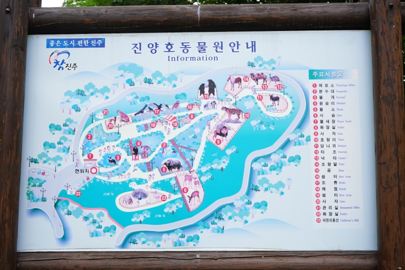
Incheon literally translates to ‘kind river.’ It’s a port city that was home to just 4,700 people when its Jemulpo port was built in 1883. Today there are 2.9 million people living in Incheon, and it’s the third most populous city in Korea.

TRAVEL ITINERARY: PART ONE

1. Seafood Noodle Soup (해물 칼국수)

2. Eurwhangni Beach (을왕리해수욕장)

3. Museum of Korean Emigration History (한국이민사 박물관)

4. Chinatown (차이나타운)

5. Jjajangmyeong Museum (자장면 박물관)

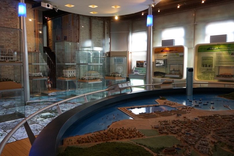
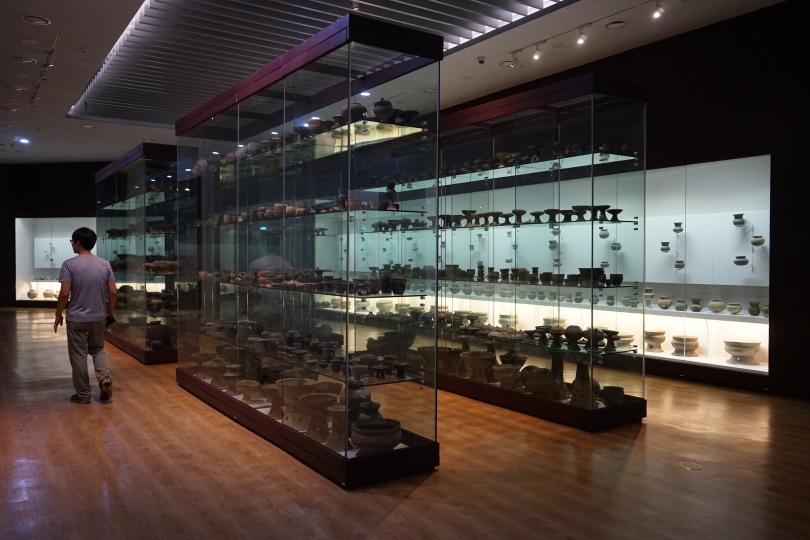
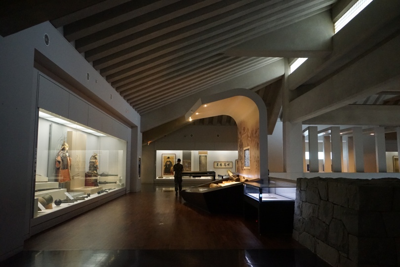
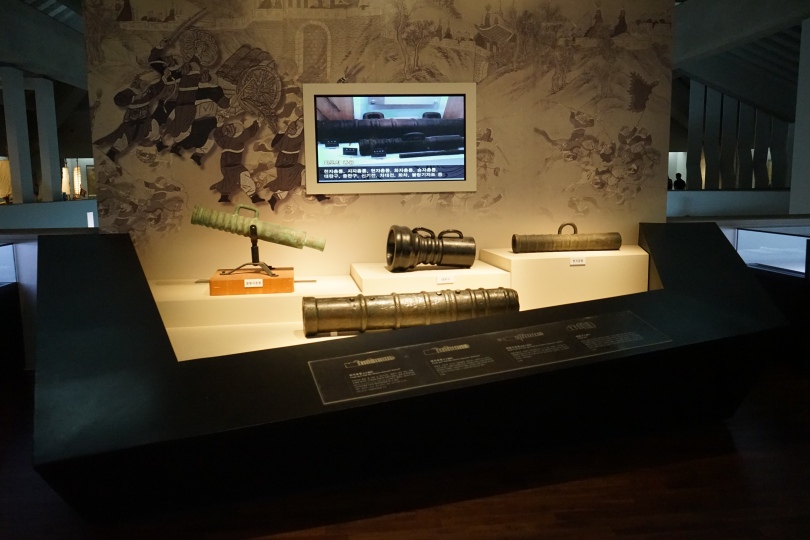
6. Open Port Museum (인천개항박물관)

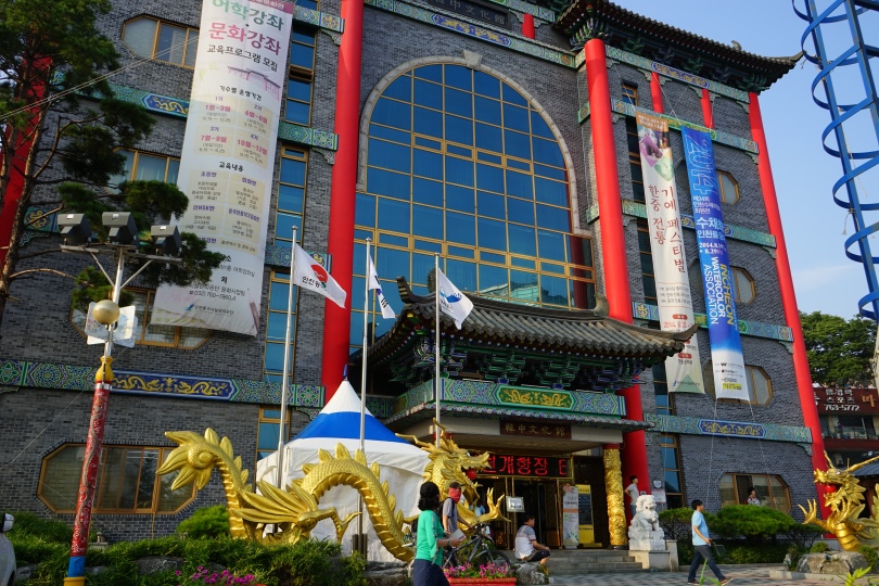
7. Korean-Chinese Cultural Center (한중문화관)
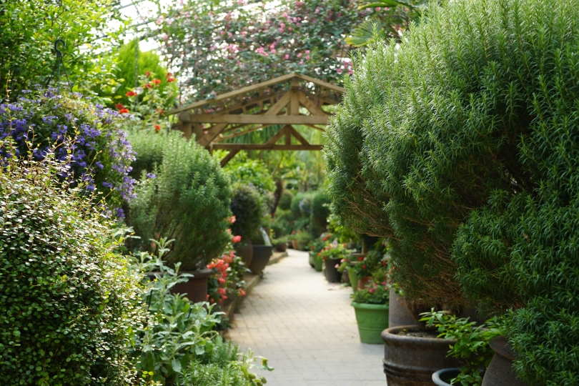
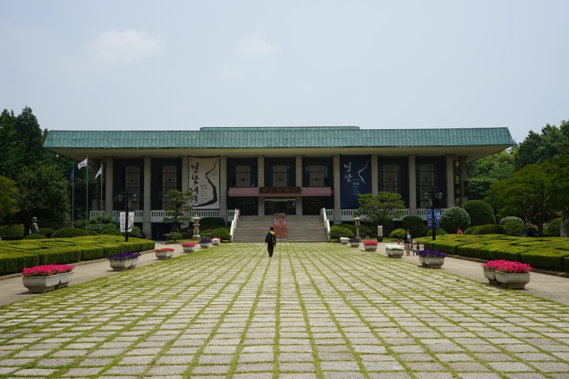
8. Jayu Park (자유공원)

9. Wolmido (월미도)

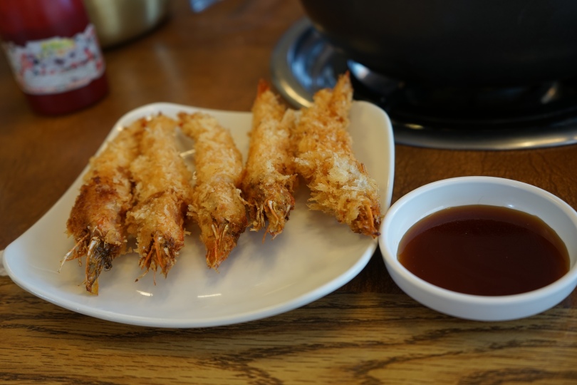
I got up late yesterday, and so it was already around noon when I arrived in Incheon. There are a lot of local restaurants near Eurwhangni Beach (을왕리해수욕장), so I headed there to get some seafood noodle soup (해물 칼국수) and some fried shrimp. I got the deluxe, more expensive version which was 33,000 won for two people, and it came with two live abalones, a live octopus, and plenty of clams.

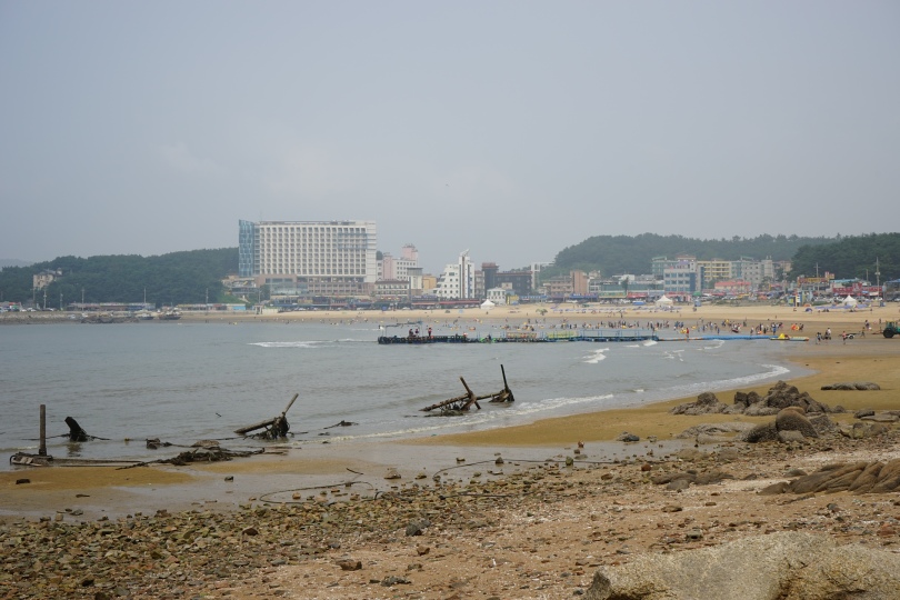
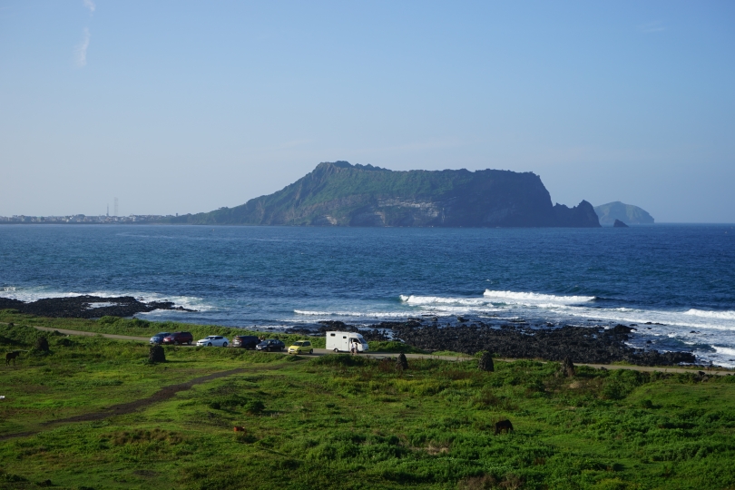
Eurwhangni Beach is the most popular beach in Incheon, so there are plenty of places to stay and eat nearby. There are lots of restaurants, cafes, and convenience stores. At this time of the year, the water was lukewarm and it was pretty muddy, so while it wasn’t the most refreshing place for a swim, it was still better than nothing.

There were some seagulls.

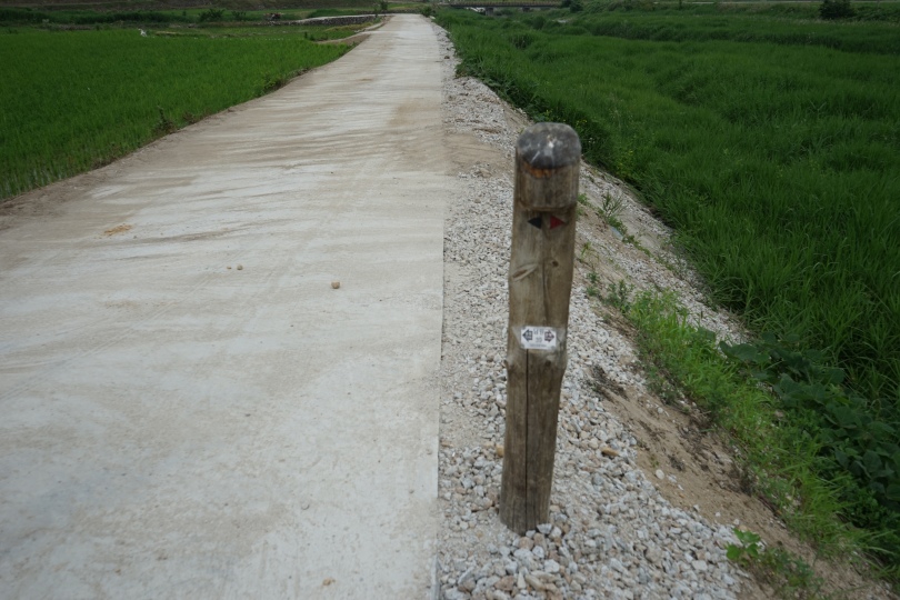
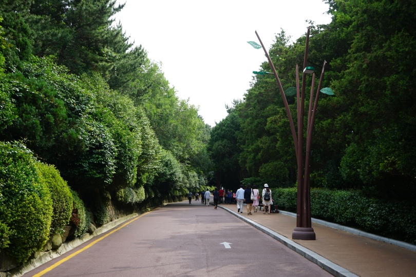
 This was a path that ran parallel to the shore.

Eurwhangni Beach Admission Fee: free

Parking Fee: free

Operating Hours: 24 hours

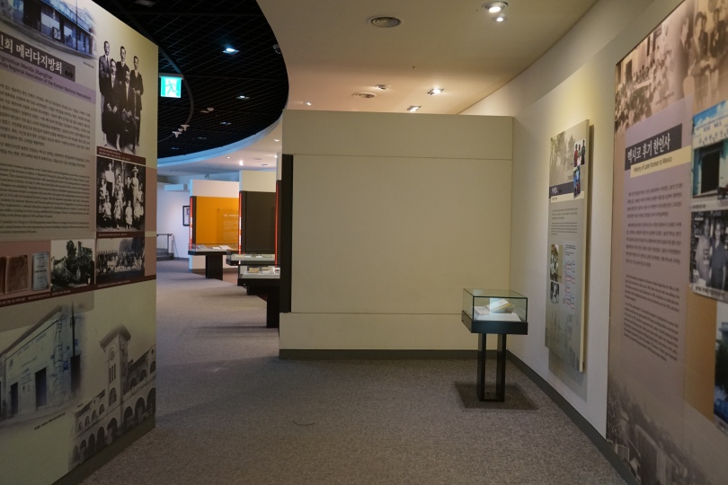
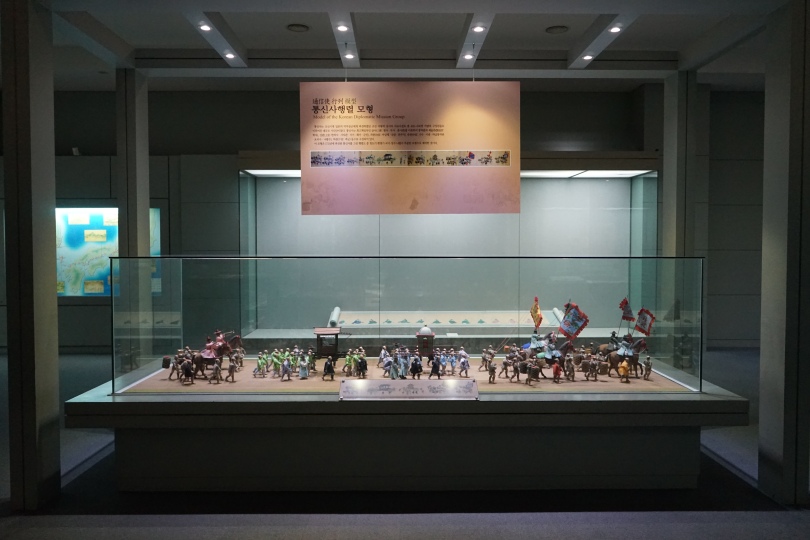
The day got hotter quickly, so I decided to head indoors. My favorite museum is the Museum of Korean Emigration History 한국이민사 박물관. Because Incheon is a port city, it was the nation’s first emigration departure site. The first Korean immigrants went to Hawaii in 1902. At the time, Hawaii had a rising demand for sugarcane, but were no longer able to depend on Chinese laborers due to the passing of the Chinese Exclusion Act. The first group consisted of 121 immigrants, but over the course of the next few years, roughly 7,500 individuals went to Hawaii to work on the sugarcane plantations. The second floor focused mainly on this diaspora, and the harsh lives of the Koreans once they got to Hawaii, while the second floor focused on emigration to South America.

Museum of Korean Emigration History Admission Fee: free

Parking Fee: temporarily free

Operating Hours: 9 am – 6 pm  / Closed Mondays & New Year’s Day

Average Viewing Time: one hour

Language: Korean, English

Contact Information: mkeh.incheon.go.kr

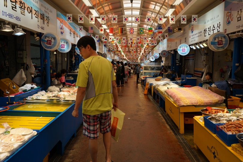
Since the Museum of Korean Emigration History is located inside Wolmido Island 월미도, I thought it would be fun to walk around the park nearby, but it was way too hot, so I went to Chinatown first. Chinatown is made up of many medium sized buildings, so there was plenty of shade. It was the only naturally forming Chinatown in Korea, and it began in 1883 with the opening of Incheon Port. The Chinese settlements there began thriving by the 1900s. It was known as Cheonggwan Street at the time and was the largest commercial district in Incheon, growing to a population of about 10,000.  There’s so much to do in Chinatown besides eating Chinese food.

There was the Jjajangmyeong Museum 자장면 박물관. I learned about how jjajangmyeong was first developed by Chinese laborers from the Shandong Province who needed a cheap and quick meal, and how over the meal has developed into a modern cultural icon.  This museum is located in the former Gonghawchun Restaurant which was a thriving Chinese restaurant built in 1908.

Jjajangmyeon Museum  Admission Fee: 1,000 won / adult  or (1,700 won for a combination ticket to the Jjajangmyeon Museum, Open Port Museum)

Operating Hours: 9 am – 6 pm  / Closed Mondays & New Year’s Day, Lunar New Years, Chuseok

Average Viewing Time: 30 minutes

Language: Korean, Chinese

Contact Information: icjg.go.kr

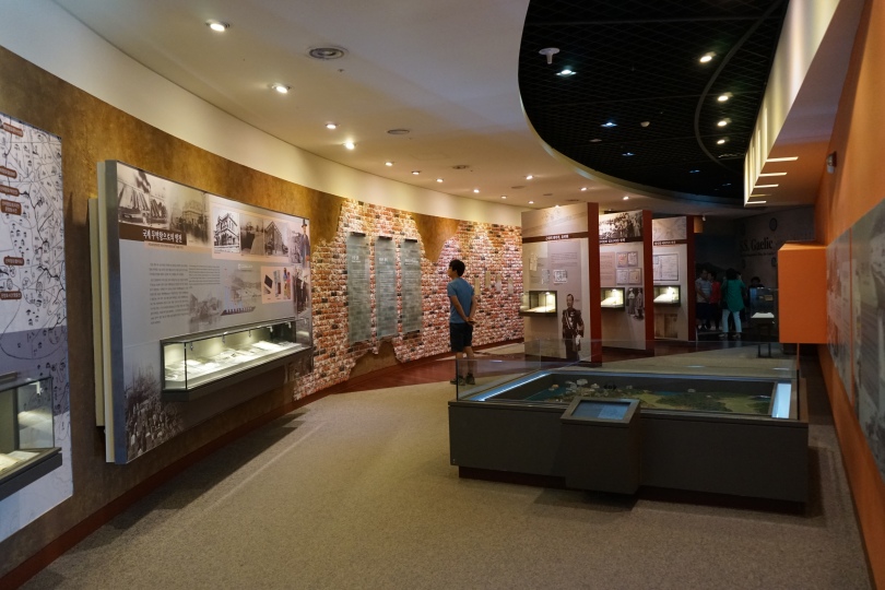
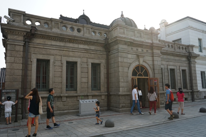
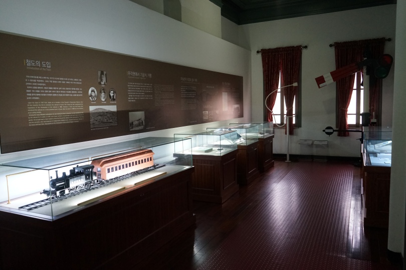
Since I purchased a combination ticket, I wanted to check out all the nearby museums before they closed. The Open Port Museum 인천개항박물관 is located in a former Japanese First National Bank, which reminded me of the museum that I had been to in Mokpo, which was another large port city. With the opening of Incheon harbor in 1883, many European, American, and Japanese official settled in Incheon, leading to a lot of great modern architecture. Jemulpo had been a quiet fishing village in Incheon but later became a crossroads of western culture. This area had the first modern style park, hotel, theater, school, railway, mint, postal office, and more.

Open Port Museum  Admission Fee: 500 won / adult  (or 1,700 won for a combination ticket)

Operating Hours: 9 am – 6 pm  / Closed Mondays, New Year’s Day, Lunar New Years, Chuseok

Average Viewing Time: 30 minutes

Language: Korean, English

Contact Information: 032) 760-7508    www.icjgss.or.kr/open_port

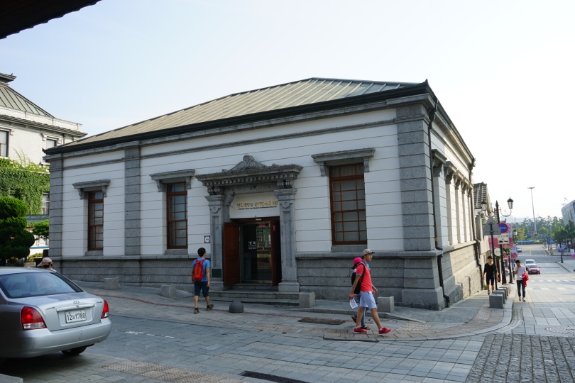
The Modern Architecture Museum 인천 개항장 근대건축전시관 is located nearby. It had a lot of similar information to the Open Port Museum, but focused a little bit more on the actual buildings. Many of these buildings still exist today around Chinatown, so it was fun to look for them after reading about them in the museum.

Open Port Museum  Admission Fee: 500 won / adult (or 1,700 won for a combination ticket)

Operating Hours: 9 am – 6 pm  / Closed Mondays, New Year’s Day, Lunar New Years, Chuseok

Average Viewing Time: 30 minutes

Language: Korean, English

Contact Information: 032) 760-7863    www.icjgss.or.kr/architecture

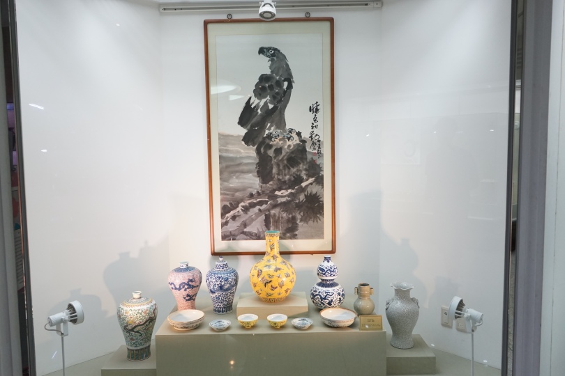
The last exhibition hall I checked out in Chinatown was the Korean-Chinese Cultural Center 한중문화관. It had a lot of interesting items to look at, but not much in terms of explanation. There was a circus type performance going on outside, and the Cultural Center often has free performances.


Korean-Chinese Cultural Center Admission Fee: free

Operating Hours: 9 am – 6 pm  / Closed Mondays, New Year’s Day, Lunar New Years, Chuseok

Average Viewing Time: 30 minutes

Language: Korean, Chinese

Contact Information: 032) 760-7865


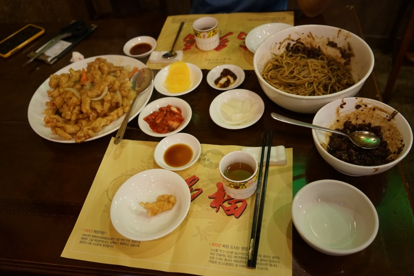
For dinner I got some standard Jjajangmyeong and tangsuyuk.

Then took a walk around Jayu Park, the first modern park in Korea.

Since it was cool enough to walk around at night, I went back to Wolmido, which is perfect for a night stroll. There are two amusement parks here that are only about 5 minutes apart from each other by foot, and they are connected by a boardwalk. There’s a large musical fountain by the boardwalk that goes off once an hour.


Next time, I plan out checking more of the islands of Incheon, and the Songdo region.

Busan Metropolitan City 부산광역시

Located in the southeastern tip of Korea, Busan is Korea’s second largest city and the largest trading port. It has lots of coastal tourist attractions, historical sites, and trendy shopping areas. The city has a well-developed public transportation system, as well as a hop on, hop off, Busan City Tour Bus, so you won’t have  to worry about getting around. This was my first time in Busan, and I know that there are a lot more things to do here that what I did in my two days, so I’ll have to come back here for round two sometime later this year.

 TRAVEL ITINERARY: DAY ONE

1. Pork and Rice Soup (돼지국밥)

2. Dongbaekseom Island (동백섬)

3. Haeundae (해운대)    

4. Dalmaji-gil Road (해운대 달맞이길)    

5. Gwangalli Beach (광안리해수욕장) 


 TRAVEL ITINERARY: DAY TWO

1. Clam Soup (재쪽국)

2. Busan National Museum (부산박물관)

3. Taejongdae Park (태종대)


I arrived in Busan around lunchtime, so I wanted to try some pork and rice soup 돼지국밥. I was really looking forward to trying it because it looked so delicious in the movie The Attorney 변호인  (2013). The main character who is based on former president Ro Mu-hyun 노무현 is poor and pulls a dine and dash at a local restaurant. Years later, he becomes a wealthy lawyer and goes back to the restaurant to apologize and becomes close with the restaurant’s owner and her son, and spends many delicious meals there. There were pork and rice soup restaurants all over Busan, especially near touristy areas. At the restaurant I went to, I ordered some bossam 보쌈 along with my soup and it only cost 7,000 won per person. It was a delicious meal of meat, fat, and salt.

After lunch, I went to Dongbaekseom Island (동백섬) which is also referred to as Dongbaek Park. It used to be an island, but is now part of the mainland. Dongbaekseom Island is named for the many dongbaek trees (camellias) and evergreens that thrive there. At the top of the island, there is a statue and a monument of Choe Chi-Won, a scholar and writer from the Silla Kingdom (BC 59 ~ AD 932).

Towards the edge of the park, there is the Nurimaru APEC House (누리마루 APEC 하우스) which is where the 13th APEC Summit was held in November 2006. Inside you can look at a gallery of photos of the world leaders who attended and some touristy things they did during their time here.

Dongbaekseom Island Admission Fee: free

Operating Hours:  24 hours

Average Viewing Time: 1-2 hours

English Availability: n/a

From Dongbaekseom Island, I walked straight to Haeundae Beach, which is located right next to the island. Haeundae Beach (해운대해수욕장) is probably the most famous beach in the country. The beach was named by scholar Choi Chi-Won (857~?) from the Silla Kingdom. When he was walking past Dongbaekdo Island, he was fascinated by it and left the carved words “Hae (sea) Un (cloud) Dae (hill)” on a stone wall on the island, and I guess it’s been called that ever since. It was cloudy that day, so a bit too cold for me to go swimming, but there was a fair amount of people in the water, but nothing close to what I’ve seen in tourism pamphlets where the whole beach is littered with people.

Haeundae Admission fee: free

Operating Hours:  24 hours

English Availability: n/a

Dalmaji-gil Road is a small walkway full of cherry blossoms and pine trees. It’s located by Haeundae Beach, on the slope of Mt. Wausan. On clear days you can see Japan’s Daema Island from the observatory at the top. The road is filled with franchise and local coffee shops, and at this point in the day it was good for a rest.

Dalmaji-gil Road Admission fee: free

Operating Hours:  24 hours

Average Viewing Time: 1-2 hours

English Availability: n/a

I decided to spend the night at Gwangalli Beach (광안리해수욕장) There were a lot of motels nearby, but unlike other beaches in Busan the restaurants at Gwangalli Beach were mostly western as apposed to local seafood restaurants. At night the bridge put on a decent light show.

Gwangalli Beach Admission fee: free

Operating Hours:  24 hours

Average Viewing Time: 1-2 hours

Contact Information:

English Availability: n/a

For brunch the next day, I got some 재쪽국 which is a clam stew with lots and lots of tiny clams, unfortunately in my pic you can’t see the clams because their hiding on the bottom of the bowl and underneath all those scallions. It’s a popular local dish for hangovers.

Then I headed to the Busan Museum. It was a good place for an overview on Korean history, but it was very similar to what I had already seen at the national museum in Seoul. I did however, really enjoy the temporary exhibit on the Yeongnam Daero 영남대고 which was a major road during the Joseon Dynasty. The exhibit showed quite a bit about scholar-travelers of the time who would write books on their travels to famous mountains, beaches, etc. Then others would use those books as travel guides and once there, they would paint pictures of tourist attractions to show all their friends and families back home. It was the low tech version of blogs and photographs.

Busan Museum Admission fee: free

Operating Hours:  9 am – 8 pm / Closed Mondays, Closed Jan 1

Average Viewing Time: 1-2 hours

Contact Information: 051) 610 – 7111    museum.busan.go.kr

English Availability: detailed translations available

Then it was off to another park, specifically Taejongdae Park 태종대. Taejongdae was named after the 29th king of Silla Kingdom, King Taejong Mu-Yeol (604-661) who was a fan of natural scenery and often came here to visit. The highest peak is 250 meters high so it was a little difficult to walk up, but there is a large shuttle bus called the Danubi Train that you can take up to the top of the hill. Since there are a lot of things to look at, I decided to walk up to the cliffs in the park, and then took the Danubi Train to go back down. Walking downhill is tough on my knees. 😦

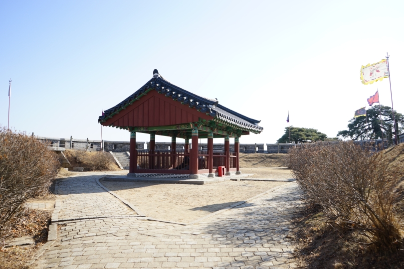
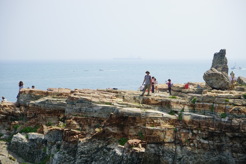
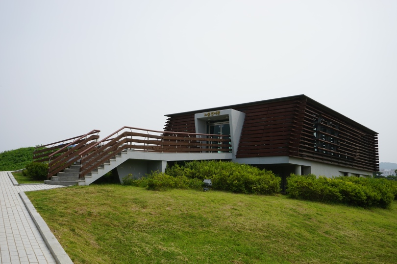
At the top of the hill there was a pretty cool looking observatory and I some great sights of the rocky shoreline. These cliffs were the highlight of this park.

Taejongdae Park Admission Fee: free

Danubi Shuttle fee: 1,500 won / adult

Park Operating Hours:  4 am – 12 am

Average Viewing Time: 1-2 hours

Contact Information:

English Availability: n/a

Relevant Links

http://english.visitkorea.or.kr/enu/SI/SI_EN_3_6.jsp?cid=262352

Gimhae City 김해시

A couple weeks ago I went on a trip to Busan and Gimhae, but I’ve been a bit lazy about uploading those photos until now. I will to upload the Busan post within the next few days.

The city of Gimhae is located in the South Gyeongsang Province 경상남도, just above Busan. Gimhae’s legacy is that it was the capital of the Gaya Confederacy (42-532) which had grown out of the Byeonhan Confederacy 변한 of the Samhan Period 삼한시대. Gaya was later annexed by the Silla Kingdom 신라, which is interesting because I found a lot of similarities between Gimhae and Gyeongju 경주 (the former capital of the Silla Kingdom.)

TRAVEL ITINERARY: DAY ONE

1. Gimhae National Museum 김해국립박물관

2. Guijibong Peak 구지봉

3. Royal Tomb of Queen Suro 수로왕비릉

4. Daeseongdong Tombs Museum and Excavation Site 대성동고분박물관

5. Gimhae Folk Museum 김해민속박물관

6. Royal Tomb of King Suro 수로왕릉


TRAVEL ITINERARY: DAY TWO

1.  Bonghwangdong Relics 봉황동

2. Former President Roh Muhyeon’s Birthplace 노무현 생가

3. Clayarch Museum

<Image Source: Gimhae Tourism Website>

My first stop of the day was the Gimhae National Museum which opened in 1998 to preserve the cultural heritage of the Gaya Confederacy. It was a pretty large place that focused chronologically on the history of cultures that lived in and around Gimhae. There was a lot of pottery and I learned about how the uses of bronze and iron led to advancements in civilizations.

Gimhae National Museum Admission Fee: free

Operating Hours: 9am – 6pm weekdays / 9 am – 9 pm sat, sun / Closed Mondays

Average Viewing Time: 1-2 hours

Contact Information: gimhae.museum.go.kr/html/en/

English Accessibility: detailed English, Chinese, Japanese translations available

After checking out the museum, I walked up the small hill behind it to get to Gujibong Peak (구지봉). This is supposedly the birthplace of the Gaya founder Kim Suro. The legend goes that in the 19th year of King Yuri of Silla (42 AD), a golden box containing 6 golden eggs came down from the sky. King Kim Suro and the five other founders of the 6 Gaya Kingdoms were born from these eggs. There wasn’t much to see here, and I actually dropped my iphone while walking up and shattered my display screen, but atleast it was a nice place for a walk. In case anyone is wondering, Technomart in Sindorim has a lot of vendors on the 9th floor who’ll fix cracked smart phones.

Guijibong Peak Admission Fee: free

Operating Hours: 24 hours

Average Viewing Time: 15 minutes

English Accessibility: n/a

On the other side of Gujibong Peak (구지봉), there is the Royal Tomb of Queen Heo 수로왕비릉, the wife of King Kim Suro. Queen Heo Hwang-ok was originally a princess from the Indian country of Ayuta who may have became aware of Korea through her brother who came to Gaya to spread Buddhism. She had many sons, and some of them took on the surname Kim and others took on her own surname. Today members of the Gimhae Kim Clan and the Gimhae Heo Clan are closely related. It used to be taboo for members of these two clans to intermarry.

RRoyal Tomb of Queen Heo Admission Fee: free

Operating Hours: 9 am – 6 pm (Nov-Feb) / 8 pm – 7 pm (Mar – Oct)

Average Viewing Time: 20 minutes

Contact Information: 055) 330-3948

English Accessibility: detailed English translations

After that I walked back to the Gimhae National Museum where I had parked my car and drove to the nearby Daeseongdong Tombs Museum and excavation site. You could probably walk to Daeseongdong if it weren’t too hot or cold out. Although it was much smaller than the Gimhae National Museum, I actually liked this place a lot more because it was more detailed and focused. The museum itself looks like a mound and is pretty cool looking at night. The museum had lots of details about the burial process, which included things like digging the graves and preserving bodies. At the time, servants were sometimes buried with the deceased nobles. Hm..

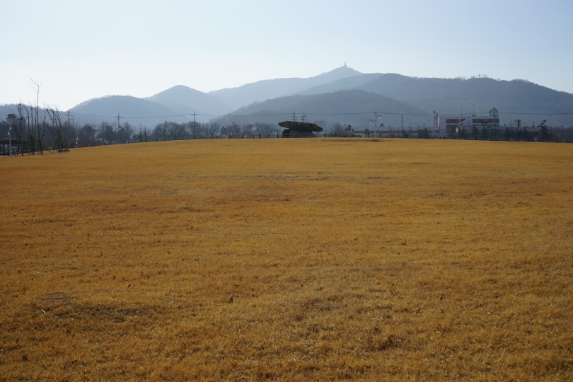
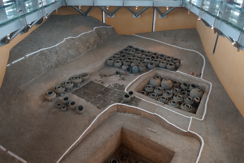
 I walked around the site outside where many tombs were found, and you’ll see white lines marking outlining the sites of old excavations. There was even a team there doing an excavation when I visited.

On the opposite side of the site from the museum, there’s an open air burial exhibition hall where you can see what an actual tomb actually looked like. Apparently the people of Gaya would build newer tombs over old ones, so many of them were destroyed. One theory for why this happened is that there was a lack of sacred land for burials, while some theorize that it was a symbolic act to destroy the old.

D

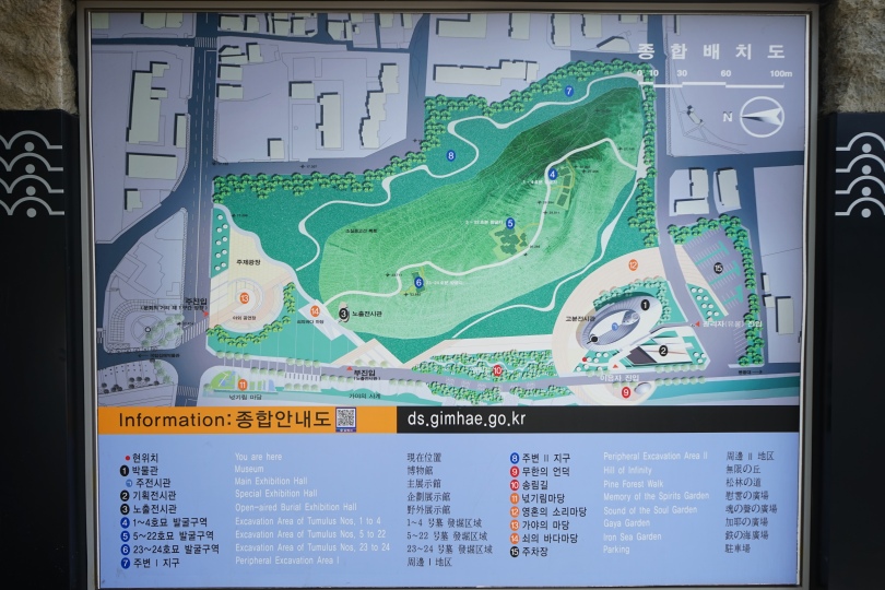
Daeseongdong Tombs Museum and Excavation Site Admission Fee: free

Operating Hours: 9 am  – 6pm 

Average Viewing Time: 1 hour

Contact Information: 055) 330-6881

English Accessibility: detailed English translations

Across the street, there’s the tourism information center if you want to check that out too. It was pretty large, and they had lots of booklets in English.

On our way to King Kim Suro’s Tomb, I saw the Gimhae Folk Museum 김해민속박물관. It wasn’t originally on my itinerary, but since it was free, I decided to stop by. It wasn’t anything special, but I would recommend checking it out if you have a lot of spare time.

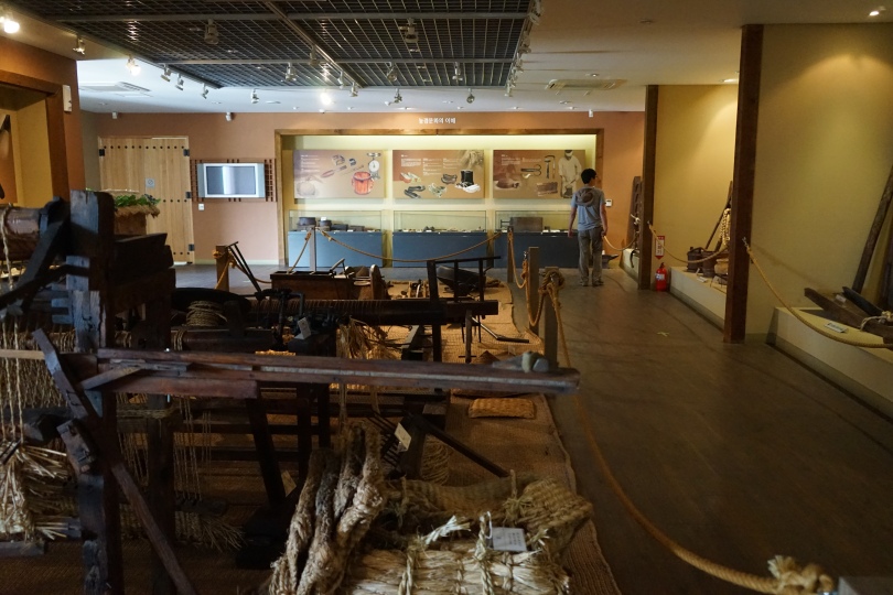
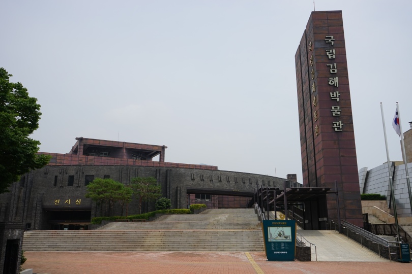
Gimhae Folk Museum Admission Fee: free

Operating Hours: 9 am – 6 pm 

Average Viewing Time: 30 minutes

English Accessibility: none

My last attraction of the day was to the Royal Tomb of King Suro (42-199).

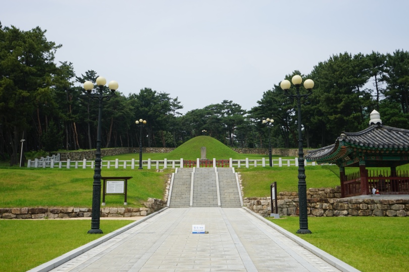
Royal Tomb of King Suro Admission Fee: free

Operating Hours: 9 am – 6 pm / 9 am – 5 pm (Nov – Feb)

Average Viewing Time: 15 minutes

Contact Information: 055) 332-1094

English Accessibility: English translations available

The next day I went to the Bonghwangdong Relics Site (봉황동유적).The site includes a shell mound exhibition from the Gaya period, and in 1920, it was the first archaeological site to be excavated in Korea.

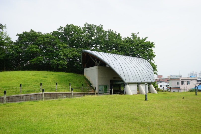
This is also where the remains of raised houses and a residential site of the Gaya period were excavated. This is significant because it was one of the first places in Korea to have homes with elevated floors.

While there, I saw this squirrel pluck a mushroom, run up a tree branch, and then eat the entire mushroom. How cute.

Bonghwadong Relics Site Admission Fee: free

Operating Hours: n/a

Average Viewing Time: 1 hour

English Accessibility: Shell mound had detailed English

I also checked out the Birthplace of Former President Roh Muhyeon 노무현 생가 aka Bongha Village 봉하마울. It’s a typical farming village, and its name comes from the mountain above it, which is called Bonghwasan. The actual birthplace of the former president Roh Moo-hyun is a brick house with a slate roof that consists of two small rooms and a kitchen. It’s a shabby house, up on a hill nearby, you can also see Roh Moo-hyun’s newer home where he moved to after his presidency, but I didn’t take any pictures of that because there were some security guards there. I think his wife still lives there today.

In the neighborhood, there’s also a warehouse exhibition center commemorating Roh Moo-hyun, specifically the things he did to help farmers and agriculture.

Across from the warehouse, there is the grave site of the former president.

I suggest trying some of the Barley Bread Cakes? 찰보리빵 which tastes just like the ones that I just tried in Gyeongju 경주. Many of the street vendors in the walking path to Roh Moo-hyun’s birthplace sold them.

If you have some time to kill, The Clayarch Museum is pretty neat. It’s an art museum that exhibits modern art, and various buildings of the museum complex are really cool looking. In case you were wondering, Clayarch refers to clay and architecture, which I guess are two things this art museum exhibits.

Jinju City 진주시

Jinju is a city located in the South Gyeongsang Province (경상남도). It’s a serene city that’s divided in halves by the Namgang River which flows west/east through the city.

TRAVEL ITINERARY: ONE DAY TRIP

1. Jinju Fortress (진주성)

2. Jinju National Museum (진주국립박물관) 

3. Lunch: Jinju Buckwheat Noodles (진주 냉면)

4. Jinyangho Lake Park (진양호 공원)

5. Jinyangho Zoo (진양호 동물원)


File:South Gyeongsang-Jinju.svg

 <Map Source: Jinju Tourism Organization>

The most well known tourist attraction in Jinju is the Jinju Fortress. It was originally made of mud during the Three Kingdoms Era, but then rebuilt with stone in 1379. That was a very good thing because the fortress was the site of a huge battle during the Imjin War (임진왜란) in October 1592. The Siege of Jinju (진주대첩) was one of the three major battles of the Imjin War along with the the Battle of Hansando (한산도대첩) and the Battle of Haengju (행주대첩).

The citizens of Jinju were able to protect their city during the first round. Unfortunately, the Japanese, under the rule of Emperor Hideyoshi, were very persistant in conquering Jinju because it was a passageway to the routes to the west coast of Korea, which the Japanese needed to control in order to wage war with China. The following year, the Japanese came back in June 1593 with 100,000 troops, and this time, they took control of the fortress and the city. Since much of the wall was destroyed during these two attacks, most of the current fortress is a reconstruction from the last few decades. In the past, there was a large village inside the fortress walls, but today it’s mostly just grassy fields inside.

One of the most famous buildings inside the fortress is the Chokseongnu Pavilion (촉석루) which is one of the three most famous pavilions in Korea. It was first built in 1241 and used as a command post during war and as a leisure venue during times of peace.

Behind Chokseongnu there is a path to Uiam Rock (의암). In order to celebrate their successful invasion in 1593, Japanese officials had a party at Chokseongnu and invited/ordered the local gisaengs to entertain them. One of the gisaengs, named Nongae (논개), managed to seduce a Japanese officer to walk towards the cliff at Uiam Rock and embraced him while jumping to death. Her suicide/assasination is a popular story of patriotism, and because of this, Nongae is one of the more famous gisangs in Korean history.

I didn’t take a picture of the rock, because there were too many people there, but here’s the nearby shrine for Nongae.

 Jinju Fortress Walls Admission Fee: 2,000 won / adult

Operating Hours: ?

Average Viewing Time: 1-3 hours

Contact Information: 055) 749-2480

English Accessability: detailed English/Chinese/Japanese translations available

Inside the fortress walls, there’s the Jinju National Museum. This museum was originally built in 1978 to introduce the culture of Gaya, but after the Gimhae National Museum (which focuses on Gaya culture) opened in 1998, the museum was reorganized to focus on the Imjin War (1592-1598.)

Here’re you’ll learn about General Kim Si-min (김시민) and the Great Battle of Jinju (진주대첩) where 3,800 Koreans fought off 20,000 Japanese soldiers. General Kim was shot towards the end of the battle, which parallels how the famous Admiral Lee Soon-Shin 이순신 also died during the Imjin War. The museum has lots of relics from that war, from both the Korean and Japanese sides.

Jinju National Museum Admission Fee: free (but requires 2,000 won / adult admission to enter the fortress walls)

Operating Hours: 9 am – 6 pm (weekdays) / 9 am – 7 pm (Sat-Sun) / Closed Mondays 

Average Viewing Time: 1 hour

Contact Information: 055) 740 – 0698    jinju.museum.go.kr

English Accessability: detailed English translations available

For lunch, I highy recommend checking out  Hayeongok (하연옥) which has two locations in Jinju, and one in the nearby city of Sacheon 사천. It’s one of my favorite restaurants in Korea. I recomend getting some Jinju Buckwheat Noodles 진주 냉면 (8,000 won) and some beef pancakes 육전 (20,000 won). The buckwheat noodles are unlike any other that I’ve ever had, and I’ve had a lot of buckwheat noodles. The noodles are thicker which makes them chewier, and the broth is meat based with only a hint of vinegar, as opposed to the vinegar doused soup based that has been the trend for the last couple of decades.

Another popular tourist location is the Jinyangho Lake Park (진양호 공원).  Jinyangho is a large lake that overlooks Jirisan Mountain. The park is huge and is based on a hill that you could spend all day walking around, if you wanted to.

At the top there is an observatory (휴게 전망대) with a cafe. This observatory is probably the most popular point in the park.


T

There’s also a zoo near the observatory. It’s not an amazing zoo, but it still had lions, tigers, llamas, monkeys, peacocks, bears, etc and it was so cheap, that it was definitely worth the money. On one hand, I think zoos are very sad places, but on the other hand I’ve learned so much more about animals from visiting them, than I would have from just reading about them and looking at photographs, so while I dislike the idea of a zoo, I really enjoy visiting them.


Zoo Admission Fee: 1,000 won / adult

Operating Hours: 9 am – 6 pm (Mar-Oct)  / 9 am – 5 pm (Nov – Feb)

Average Viewing Time: 1 hour

English Accessability: Korean only, but I think English translations aren’t really necessary for a zoo

Jinju is a small city, so it’s perfect for a day trip.


Relevent Links

http://www.travelwireasia.com/2012/11/destination-jinju-fortress-jinju-city-gyeongsangnam-do/

Jirisan National Park (Namwon) 지리산 국립공원 (남원)

At 1,915 meters, Jirisan (지리산) is the second highest mountain in Korea. The highest is Hallasan (한라산) which is 1,950 meters and located in Jeju Island (제주도). Jiri literally means “a place where the foolish become wise,” and that makes sense because it’s a serene place where you’ll have a lot of time to think and ponder about life.

Jirisan National Park (지리산국립공원) stretches across seven cities and counties (Namwon, Jangsu, Gukseong, Gurye, Hadong, Sancheong, and Hamyang.) It was designated the first Korean national park in 1967. This was my first time there, and I went camping for four days in the Namwon (남원) side, which is the northwest portion of the park.

TRAVEL ITINERARY: DAY ONE

1. unpack at Dalgung Camping Site (달궁야영장)

2. Dalgung Creek (달궁계곡)


TRAVEL ITINERARY: DAY TWO

1. Baemsagol Creek & Visitor Center (뱀사골계곡 & 뱀사골탐방안내소)

2. Baemsagol Hiking Trail (뱀사골 등산)


TRAVEL ITINERARY: DAY THREE

1. Nogodan Hiking Trail (노고단 등산)


TRAVEL ITINERARY: DAY FOUR

1. Dulegil Course #1

It took me about 4.5 hours to drive to Jirisan. There are buses available, but if you plan on staying here a couple of days, I highly recommend coming here by car since local buses don’t run frequently.

Jirisan is a popular tourist attraction, so there are many hotels, motels, pensions, minbaks, and campsites throughout the park. Since the weather has been really nice, I decided to go camping. There are several campsites inside Jirisan National Park (Dalgung 달궁, Dukdong 덕동, Baemsagol 뱀사골, Naewon 내원, Somakgol 소막골, etc.) I went to the Dalgung Campground 달궁야영장 because it was the largest. This particular site has around fifty slots that are available through online reservation only, and a much larger area that is first come first serve. I went on a weekday, so I didn’t have to make a reservation ahead of time. There were no showers there, but the bathrooms and the sinks for washing dishes were extremely clean because park employees came and cleaned them every morning. It cost 16,000 won per night.


This general area that I stayed in is called Dalgung 달궁 which translates to “Moon Palace” because it’s the site of a palace that King Hyo (효왕) of the Mahan Confederacy built in order to protect himself from Jinhan invaders. The Mahan Confederacy (along with Jinhan and Byeonhan Confederacies) was one third of the Samhan Period which existed  during the final century BCE and the early centuries CE. There is no longer a palace here, but there was a reconstructed hut made to look like a typical Mahan home.

In Dalgung (달궁), there is also the Dalgung Creek (달궁계곡) rights across the street from the campsite and a neighborhood of around 20 pensions and restaurants about 5 minutes north of the campsite by foot.

It got dark around 7:30 so after setting up my tent, wading in the creek, and checking out the area, I went to bed early.

The next day it was pretty sunny, so I decided to go swimming in Baemsagol Creek (뱀사골) which is only about fiteen minutes away by car. Near the entrance of Baemsagol Creek, there is the Baemsagol Visitor Center (뱀사골탐방안내소), which I checked out first.

The visitor’s center was pretty large. The first floor gave information on various trails in the park and the different kinds of wildlife that live in Jirisan as well as the history of preservation of the park. The second floor focused on life in Jirisan which consisted mostly of partisan guerilla warriors who hid in the mountain during the Korean War.

Baemsagol Visitor Center Admission Fee: free

Operating Hours: 8 am – 7 pm (June, July, Oct, Nov) / 9 am – 5 pm (other months

Average Viewing Time: 30-60 minutes

Contact Information: 063) 625-8914    jiri.knps.or.kr

English Accessability: first floor no English translation available, second floor very detailed English

From there, there was a pretty easy trail that followed the Baemsagol Trail. The area is called Baemsagol which translates to ‘dead snake valley’ because there was a legend originating from a nearby Buddhist temple called Songlimsa (송림사) that said a monk could become immortal if he prayed on a rock here. One day a monk tried this out, but the villagers only found a dead serpent that had failed to become a dragon. This legend doesn’t really make sense to me, but maybe that’s because I’m missing some of the details.


<Image Source: jirisantour.com>

Along the way I saw this rock that is supposed to look like a resting dragon. It’s called Yoryongdae 요룡대.

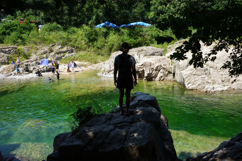
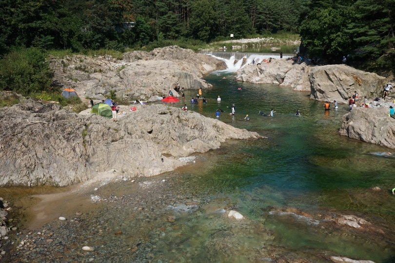
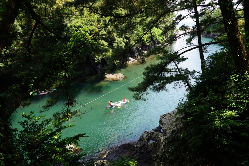
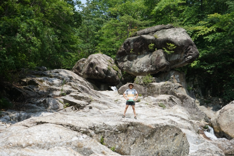
There were a lot of places in the creek that were deep enough for swimming.

 The third day I wanted to do some hiking. Originally I wanted to go to Cheonwangbong (천왕봉) which is the highest peak in Jirisan at 1,915 meters. However, Cheonwangbong is located on the opposite side from where I was camping, and after doing some research I realized that I probably wasn’t fit enough to climb it, so I opted for one of the easier trails.

Nogodan (노고단)  is another popular peak and it was located only ten minutes away from the Dalgung camping site. Although it’s 1,430 meters above sea level, it was extremely easy because you can drive up to about 1,000 meters, and then from there there’s a dirt car road all the way to the top. It took under two hours to hike from the Seongsamjae Reststop (성삼재 휴개소) to Nogodan (노고단).

 Here’s the parking lot of the Seongsamjae Reststop.  There was a Cafe Bene, La fuma,  a convenience store, bathrooms here, as well as a great view of the mountain.


The hike was fairly easy. There were these markers along the way letting you know how many miles left until the top.

Here’s Nogodan. The name means “the place where Nogo lived.” Nogo was an old lady who lived here during the Silla dynasty. At the time, a lot of Silla warrior came to Nogodan in the summer to train, because this was one of the coolest areas due to strong winds here. It was a good thing I wore long pants, because it was a lot colder here than it was at the bottom.


<Image Source: jirisantour.com>

My last day day at Jirisan National Park, I decided to take one of the dulegil (walking trails).  The circumference of the base of Jirisan is about 300 km and this is divided into roughly 20 trails which are refered to as dulegils. Any sort of easy walking path at the base of a mountain is called a dulegil (들레길). I took dulegil course #1 which starts in Jucheon (주천) and ends in Unbong (운봉) which are two neighborhoods in Namwon City (남원시). There course is 15.1 kms long, and it supposedly takes 6 hours, but I power walked through most of it and it only took me 4.5 hours.

Here’s the parking lot and the information booth at Jucheon (주천). Make sure to pick up a map here.


<Image Source: jirisantour.com>

Throughout the path there were posts telling you how many kms you  had left.

Course number one went through farms, small mountains, creeks, and half way through I stopped by at a makeshift restaurant to have some noodles (잔치 국수) and scallion pancakes (파전). There were quite a few hole in the wall type of  local restaurants, so you don’t have to worry about packing food, but make sure to bring plenty of water, because there were a lot of uphill parts that will tire you out.


<Image Source>

Usually when I go travelling, I’ll check out several places in each county or city each day, but in Jirisan I pretty much stayed in one area and did just one thing each day. I still feel like I did a lot here though, and hopefully by this time next year, I’ll build up my endurance enough to climb Cheonwangbong.


Relevent Links

http://english.visitkorea.or.kr/enu/SI/SI_ET_6_2.jsp